


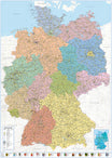

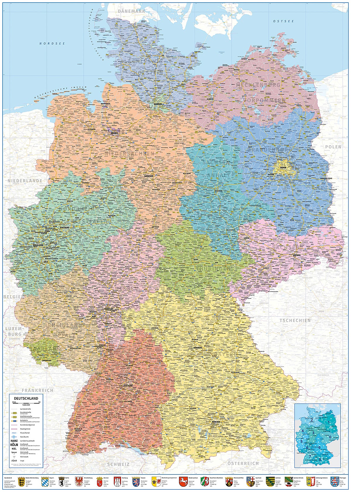
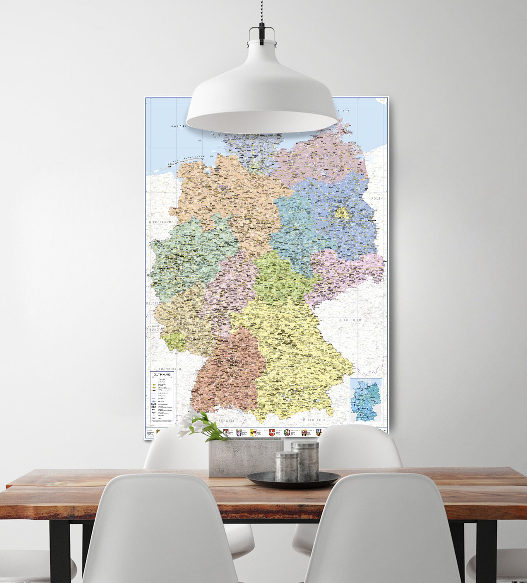
Germany map XXL poster political map 100x140
Political map of the Federal Republic of Germany
Item number: R830100
Tax included. Shipping calculated at checkout
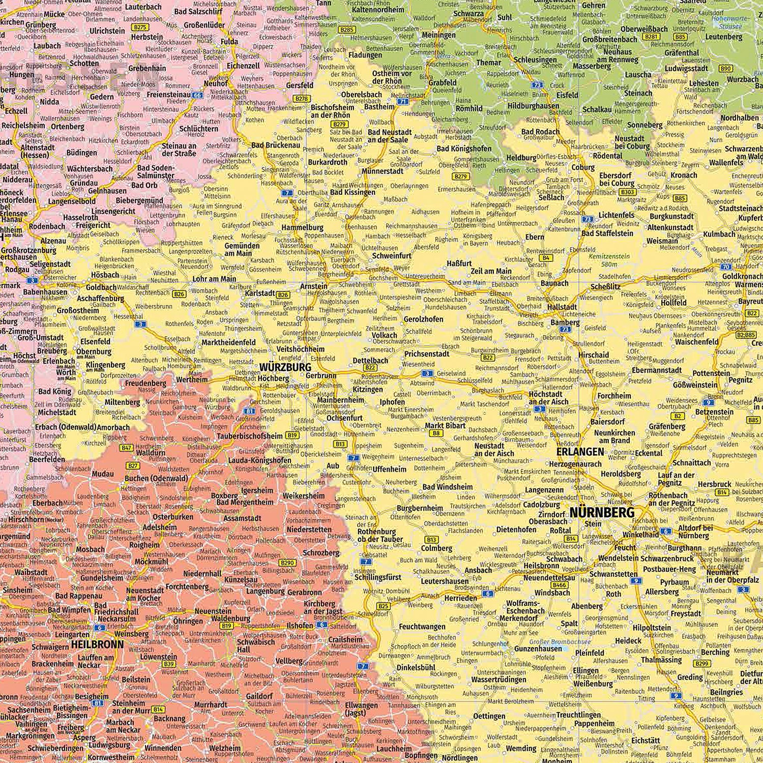
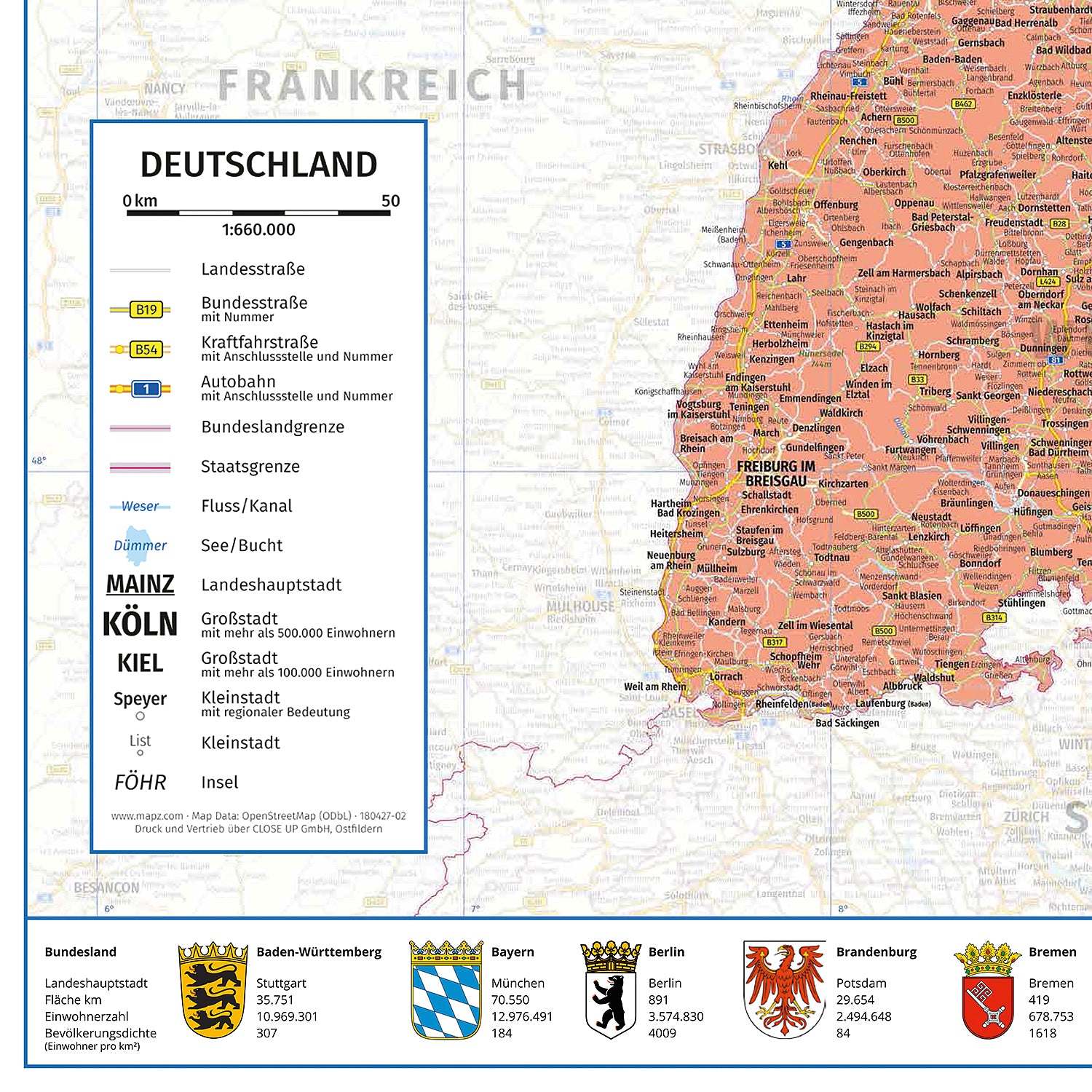
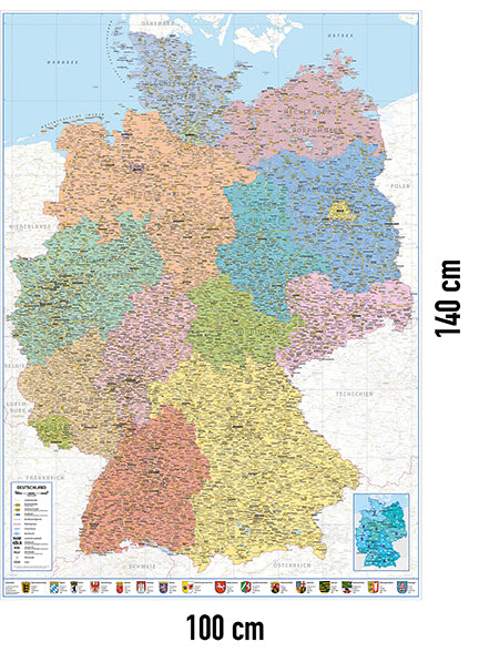
Clear map of Germany. The 16 German The federal states are separated by color. The population of the Cities are quickly identified by different font sizes The capital cities are additionally underlined.
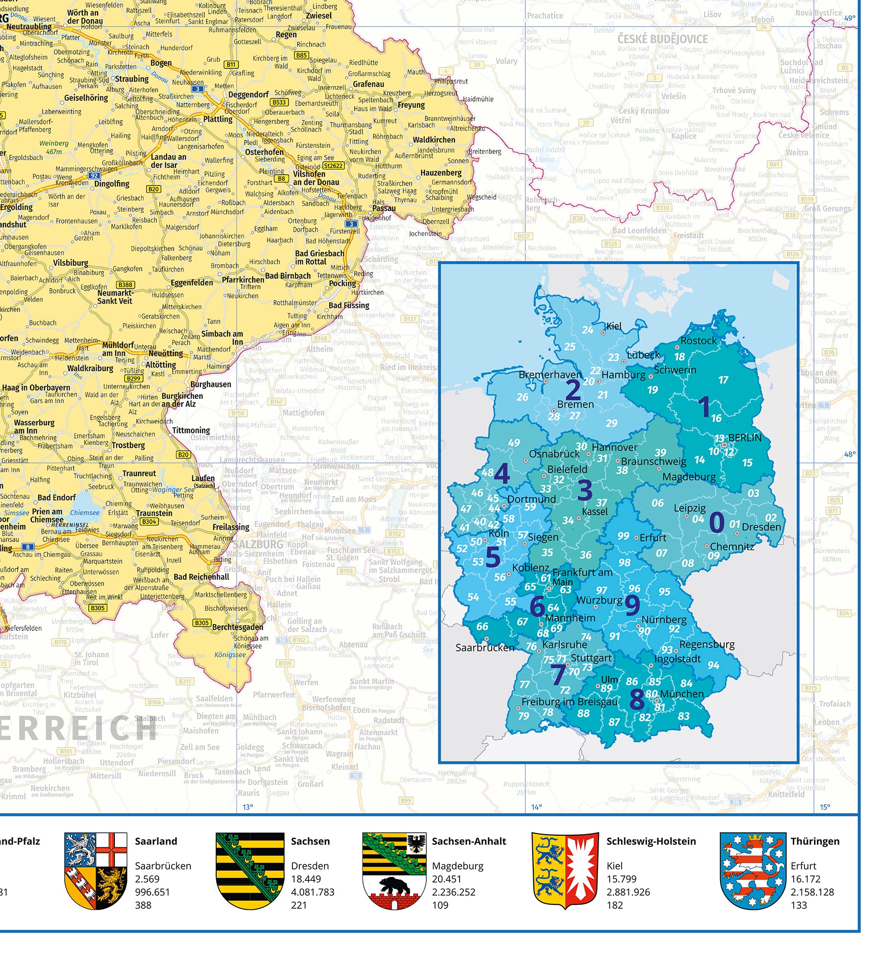
A legend below on the left explains the various symbols. Roads such as motorways and federal highways, borders and Bodies of water and rivers can be seen on the map. The lower right part shows the postcode areas of the Federal Republic graphically The bottom bar shows the coats of arms of the various Federal states with important information, such as the state capital, Area, population and population density. The adjacent Neighboring countries are shown in reduced color.
Plan your event with the premium poster on sturdy 200 gr./m² paper next tour through beautiful Germany or learn by means of the political map to better understand the nature of the Federal Republic. Great wall decoration for your office, study or classroom in the school.
Everything at a glance:
- Detailed political presentation : All Federal states, capitals and important geographical features at a glance View.
- High-quality printing : Durable materials ensure a clear and colorful display. Made in GERMANY.
- Versatile use : Perfect for classrooms, Offices or as wall decoration in living rooms.
- Size : With generous dimensions of 100 x 140 cm it ensures maximum visibility.
Width: 100.0 cm
Height: 140.0 cm
Weight: 0.1 kg
EAN: 4057786786006
For orders placed before 11am, dispatch on the same day
from 75€ order value*